Seismic reflection surveys
Type of resources
Topics
Keywords
Contact for the resource
Provided by
Years
Formats
Representation types
Update frequencies
Scale
Resolution
-
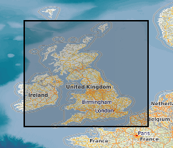
This digital data set contains original files of seismic reflection survey sections. Most data are within the UK Onshore area; although there are some UK near-shore and offshore (North Sea, Irish Sea) and foreign data. Most data were acquired for commercial hydrocarbon exploration and subsequently provided to BGS for use on specific projects. Some data were acquired by BGS and other public-sector bodies, e.g. BIRPS (British Institutions Reflection Profiling Syndicate), for academic research. These data are used for workstation-based interpretation. Some are kept as archive copies. There are approximately 50 tapes and 15 Exabyte cartridges. The data are mostly concentrated in areas prospective for coal, oil and gas.
-
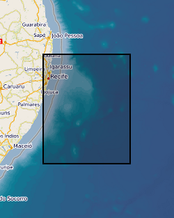
The dataset consists of: (1) Listing of full site survey package of geophysical data held in the IODP Data Bank in support of proposal 864. Details of how to obtain existing freely available or commercial proprietary data are included. (2) Final version of Full Science Proposal 864, which contains: description and illustrations of the regional stratigraphy of Pernambuco Plateau, as interpreted by the Virtual Site Survey project; site summary sheets for all proposed drill sites based on the Virtual Site Survey. (3) A complete list of all deliverables associated with this project is provided in the Data Archiving Report.
-
The Seismic Line Index database stores summary administrative information about the collection of printed seismic sections, Original Seismic Sections dataset (ORIGSEISECS). This includes: details of data ownership or source, date of acquisition, purpose of survey, confidentiality, media, survey acquisition and processing parameters, and storage location in BGS. Almost all data are within the UK Onshore area; although there are some UK near-shore and offshore (North Sea, Irish Sea) and foreign data. Most data were acquired for commercial hydrocarbon exploration and subsequently provided to BGS for use on specific projects. Some data were acquired by BGS and other public-sector bodies, e.g. BIRPS (British Institutes Reflection Profiling Syndicate), for academic research. There is also scope to add relevant information about the data held in Copy Seismic Sections (COPYSEISECS) and Original Seismic Shotpoint Location Maps (ORIGSPMAPS) datasets.
-
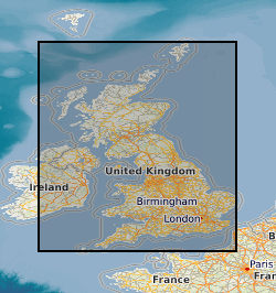
This database stores down-hole stratigraphic data to complement the seismic surface picks stored in the Seismic Locations And Sections Database (LOCSEC). Because these surfaces are chosen for their visibility on seismic data, they may not be directly equivalent to established BGS lithostratigraphic and/or choronstratigraphic divisions. However, the local coding system is based on and can relate to the BGS stratigraphic LEXICON. Stratigraphic picks are stored in terms of depth and seismic one-way travel time. Local borehole summary information (location, elevation, etc.) is used because both onshore and offshore boreholes are stored in this database. These data can be related to the BGS onshore borehole database by borehole registration, and to the offshore well database by DTI well-id. Additional tables (under development) provide information on hydrocarbon tests and their results. Almost all data are within the UK Onshore area; although there are some UK near-shore and offshore (North Sea, Irish Sea).
-
This data set contains the following original data for the deep seismic reflection surveys conducted by the BGS in various parts of the UK. The data consists of observers' logs, surveyors' reports, location data tapes, field data recording tapes and processed data tapes. The processed tapes are at various stages of processing from demultiplexed field data to migrated stack (not all available for all profiles) These data are kept as archive copies. They are generally available for academic and commercial use, subject to payment of fees (and, in a few cases, the agreement of co-owners of the data rights). There are Approximately 20 files of written records and 200 tapes.
-
This document data set contains original prints, on paper, sepia or film, of seismic reflection survey location (navigation) maps. These provide the location data for the seismic sections of the Original Seismic Sections (ORIGSEISECS) and Copy Seismic Sections (COPYSEISECS) datasets. Almost all data are within the UK onshore area; although there are some UK near-shore and offshore (North Sea, Irish Sea) and foreign data. Most data were acquired for commercial hydrocarbon exploration and subsequently provided to BGS for use on specific projects. Some data were acquired by BGS and other public-sector bodies, e.g. BIRPS, for academic research. All maps are digitised upon receipt (see LOCSEC database) and then archived in this data set. (Copies used to be used for interpretation purposes but this is no longer the case.) Documents stored rolled in tubes. Approx 800 maps.
-
The Seismic Locations and Sections database (LOCSEC) stores digitised seismic reflection survey location and line-interpretation data. Supplementary data stored includes map projection information and rock-unit seismic velocity data. The data are grouped by interpretation project area. Location data are input from digitised seismic shotpoint (SP) or common depth point (CDP) maps, or from direct input of digital navigation data. [See: Original Seismic Shotpoint Location Maps (ORIGSPMAPS) and Digital Seismic Shotpoint Location Maps (DIGSPMAPS) datasets]. Line-interpretation data are input from digitised pick-lines on manually interpreted printed seismic sections. [See: Copy Seismic Sections dataset (COPYSEISECS)]. In-house software is used for data management and display, to perform interpretation related tasks, e.g. depth-conversion, and to merge data into X, Y, Z form for input to 3D mapping and modelling packages such as EarthVision. Data in LOCSEC may also be related to the borehole interpretations held in the Stratigraphic Surfaces Database (SSD). Almost all data are within the UK Onshore area; although there are some UK near-shore and offshore (North Sea, Irish Sea) and foreign data. Most data were acquired for commercial hydrocarbon exploration and subsequently provided to BGS for use on specific projects. Some data were acquired by BGS and other public-sector bodies, e.g. BIRPS, for academic research.
-
This document data set contains paper copies of many of the seismic reflection survey sections from the original seismic sections data set (ORIGSEISECS) . These have been made for interpretation. Most data are within the UK onshore area; although there are some UK near-shore and offshore (North Sea, Irish Sea) and foreign data. Most data were acquired for commercial hydrocarbon exploration and subsequently provided to BGS for use on specific projects. Some data were acquired by BGS and other public-sector bodies, e.g. BIRPS (British Institutes Reflection Profiling Syndicate ), for academic research. The documents are dyeline prints or plain-paper photocopies. They are stored folded in boxes, approx 40 sections per box, approx 530 boxes. There are a lot of duplicates, there being an interpreted and uninterpreted copy of many profiles. Mostly concentrated in areas prospective for coal, oil and gas.
-
Fault analyses used to estimate underlying dyke properties, imaged in 3D seismic reflection data. The seismic reflection data are located offshore NW Australia and image a series of Late Jurassic dykes and overlying dyke-induced normal faults; these structures occur within a sedimentary basin and are now buried beneath several kilometres of rock. The specific seismic reflection dataset used for this study so far is the Chandon 3D survey, which is freely available through https://www.ga.gov.au/nopims. Other 3D seismic surveys (e.g., Glencoe) near Chandon will be used in due course to extend the study area. Analyses of these faults uses an array of point pairs, defined by X, Y, and Z co-ordinates, that mark where certain sedimentary beds are intersected by the fault in its footwall and hanging wall. Mapping of these points every 125 m along each studied fault, for 11-14 sedimentary horizons, was conducted using Petrel seismic interpretation software. From the footwall and hanging wall point pairs, the throw, heave, displacement, and dip of each fault was calculated. By measuring distances between corresponding point pairs on opposing faults, graben width properties and estimated down-dip fault continuations were calculated. The expression of dyke-induced faults observed at the surface in active volcanic areas is often used to estimate dyke location, thickness (expected to roughly equal the heave on overlying faults), and upper tip depth (expected to occur where overlying, oppositely dipping faults meet; i.e. the point of the ‘V’). This study represents the first time natural dyke-induced faults and underlying dykes have been imaged in 3D and quantitatively studied. The dataset presented here allows hypotheses concerning relationships between dyke-induced fault geometries and dyke properties to finally be tested, and provides insight into normal fault kinematics; this will be useful to structural geologists and volcanologists.
-
This document dataset contains original prints, on paper, sepia or film, of seismic reflection survey sections, dating from the 1960s. Most data are within the UK onshore area; although there are some UK near-shore and offshore (North Sea, Irish Sea) and foreign data. Most data were acquired for commercial hydrocarbon exploration and subsequently provided to BGS for use on specific projects. Some data were acquired by BGS and other public-sector bodies, e.g. BIRPS (British Institutions Reflection Profiling Syndicate), for academic research. This data set is a master set; copies must be used for interpretation purposes. Documents stored rolled in tubes, approximately 10 sections per tube, approx 850 tubes. The data are mostly concentrated in areas prospective for coal, oil and gas.
 NERC Data Catalogue Service